The AI boom is taking all the stops, and satellite data analytics is the next step. Downstream space segments are facing an urgent need to adopt AI and drive their offerings to meet the next generation needs of their customers. But will it last or is it just hype?
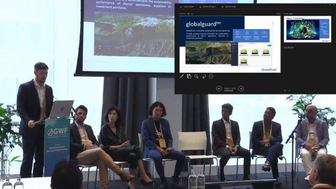
To discuss these points, a session entitled “Convergence of technologies to drive the downstream space segment” was held on the third day of the Geospatial World Forum 2024.
Moderated by Novaspace Manager Alexis Conte, the session discussed new-age technology and how it can benefit society and help solve modern-day problems.
Data Accountability
Kumar Navulur, founder and CEO of GeoCognition, explained the effort to bring gaming technology to geospatial: “When you look at AR, VR, natural language processing, large-scale language models, these are going to impact how we glean information from pixels.”
“When you start analysing data you need to think about using multiple scales and abstractions. If you’re analysing the whole planet you don’t want to go down to 30cm if you’re a forestry worker. Industry, including academia, can take a step back and think about how information can be used at multiple scales for different applications,” he added.
Steve Spittle, CTO and co-founder of GlobalTrust, says on-board processing is an attractive trend because it allows for cost-effective execution of analytics, data compression, and more. “You can store more data and explore new aspects all the way up to complex analytics.”
“But when you put that into action and get that data to your customers, how much trust and confidence can you have in the deliverables? You need to ensure traceability throughout the process,” he stressed.
“You can achieve that with on-board processing, but you need to think about what the end user wants before you just jump in and innovate,” Steve added.
The power of SAR
Speaking about the new era of capabilities of ESA’s Copernicus constellation, Gurin Dedé, Copernicus Space Segment Engineering Coordinator at the European Space Agency (ESA), explained that seven of the first generation Sentinel satellites are operational, covering a wide range of technologies including C-band SAR, multispectral and more.
“What’s unique about the Copernicus constellation is that it provides an integrated system where all this data is fed into a range of thematic information services used to support the Green Deal and address climate change issues such as wildfires, iceberg tracking, biomass mapping, air pollution and cyclone tracking,” she said.
The constellation is currently expanding, with six new missions under development, scheduled to be launched between 2026 and 2028.
Meanwhile, Keizo Fujiwara, General Manager of the Solution Development Department at Synspective, reiterated the importance of SAR in various aspects of human life: “Why SAR? As you know, unlike optical sensors, SAR sensors can capture images of the sky regardless of time, weather, or meteorological conditions. This allows StriX to capture an area of over 1,000 square kilometers at a time anywhere in the world with a resolution of 0.9 to 3.6 meters.”
Synspective currently has three satellites in orbit from its StriX constellation, with one more scheduled for launch this Sunday.
What the data means
“There is an urgent need for downstream applications, especially given what we’ve seen over the past four years: the pandemic, various geopolitical conflicts, and climate change and its impact on almost everything, all of which are tied to space in some way,” said Navaneeth Souri, senior product marketing manager at UP42.
When thinking about solutions, space emerges as one of the fundamental tools, he emphasized.
He spoke about the convergence of various technologies and space technology, explaining how satellite-based Earth observation capabilities have grown rapidly.
“The cost of satellite launches has come down and, naturally, the number of satellites being launched is increasing. On the new-age technology front, we are also seeing an increase in cloud computing, GenAI, machine learning and AI-based geospatial analytics,” he added.
This has had a major impact on geospatial platforms overall, and combining the two has also improved service to end users, Navaneeth said.

